Wamkelekile, Welkom
UCT researchers further global effort to study Antarctic ice loss
10 April 2025 | Story Nicole Forrest. Photos Supplied. Read time 7 min.
A delegation of University of Cape Town (UCT) scientists from the Polar Engineering Research Group (PERG), led by Professor Sebastian Skatulla of UCT’s Department of Civil Engineering, recently embarked on an expedition to the Fimbul Ice Shelf in Antarctica. UCT News spoke with Professor Skatulla about the why and how of this ambitious project.
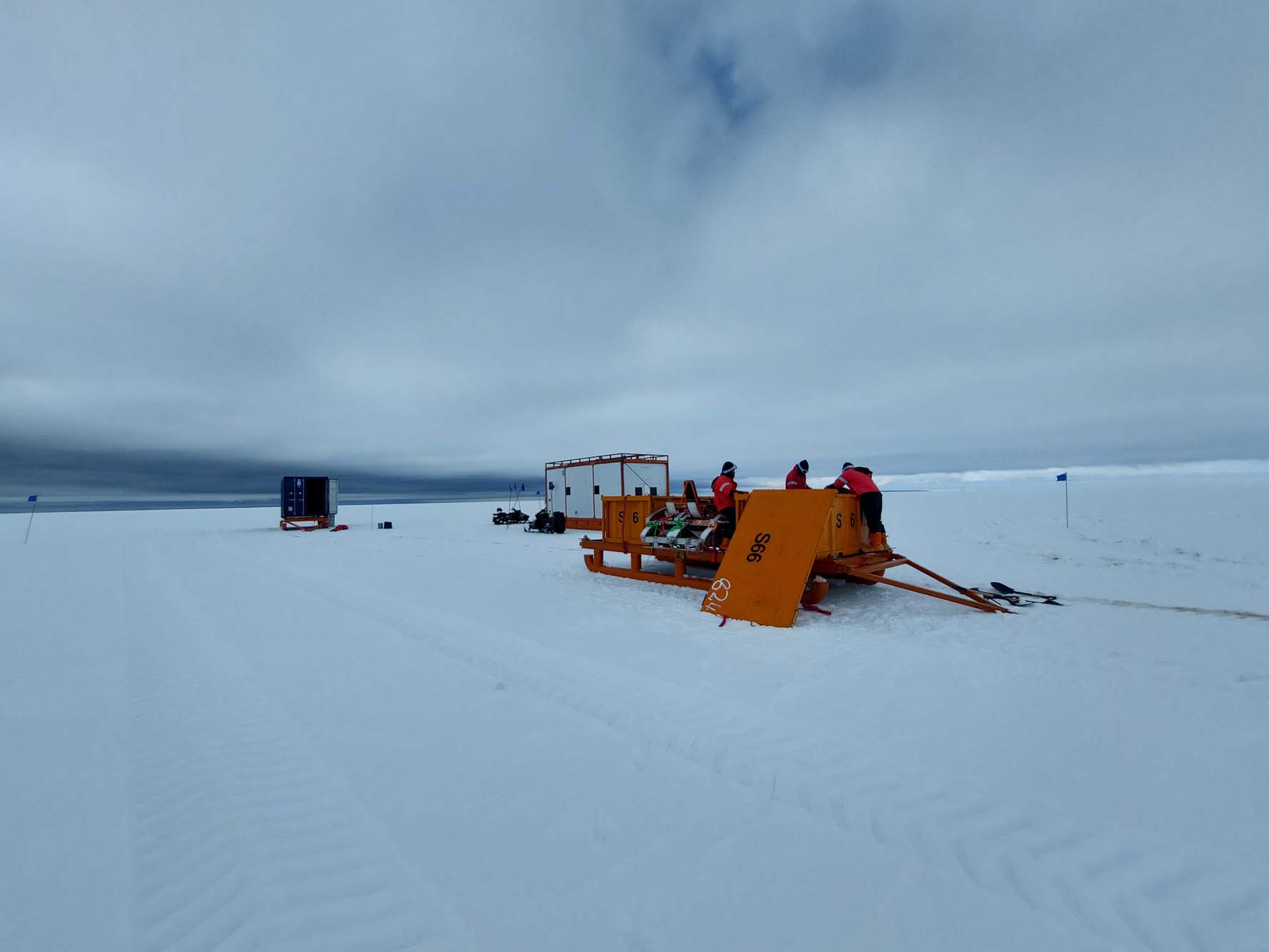
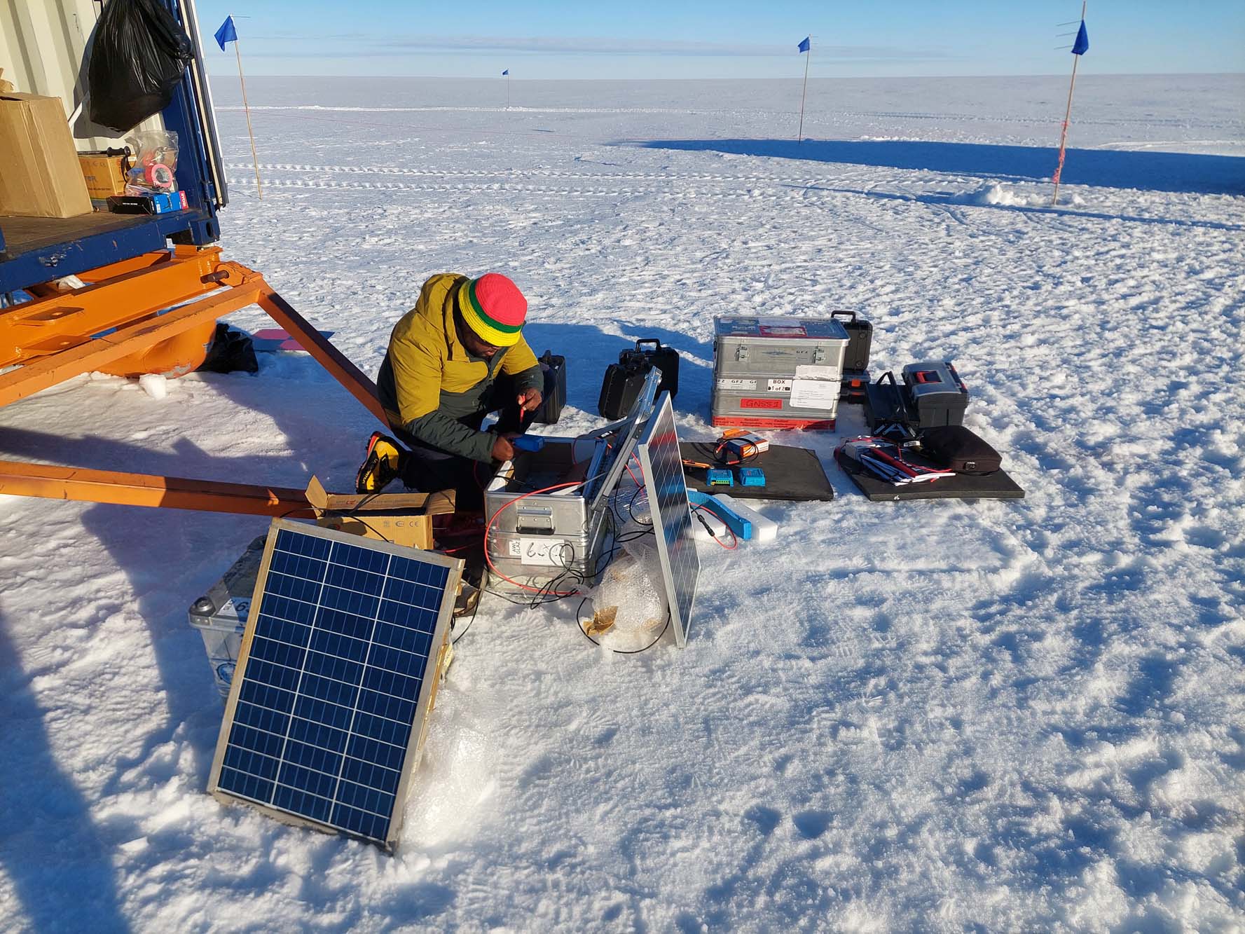
In December 2024, the PERG team set off as part of the South African National Antarctic Expedition (SANAE) 64 on a mission to deploy advanced global navigation satellite systems (GNSS) and radar equipment that is capable of monitoring the thickness, internal composition, movement and deformation of the Fimbul Ice Shelf.
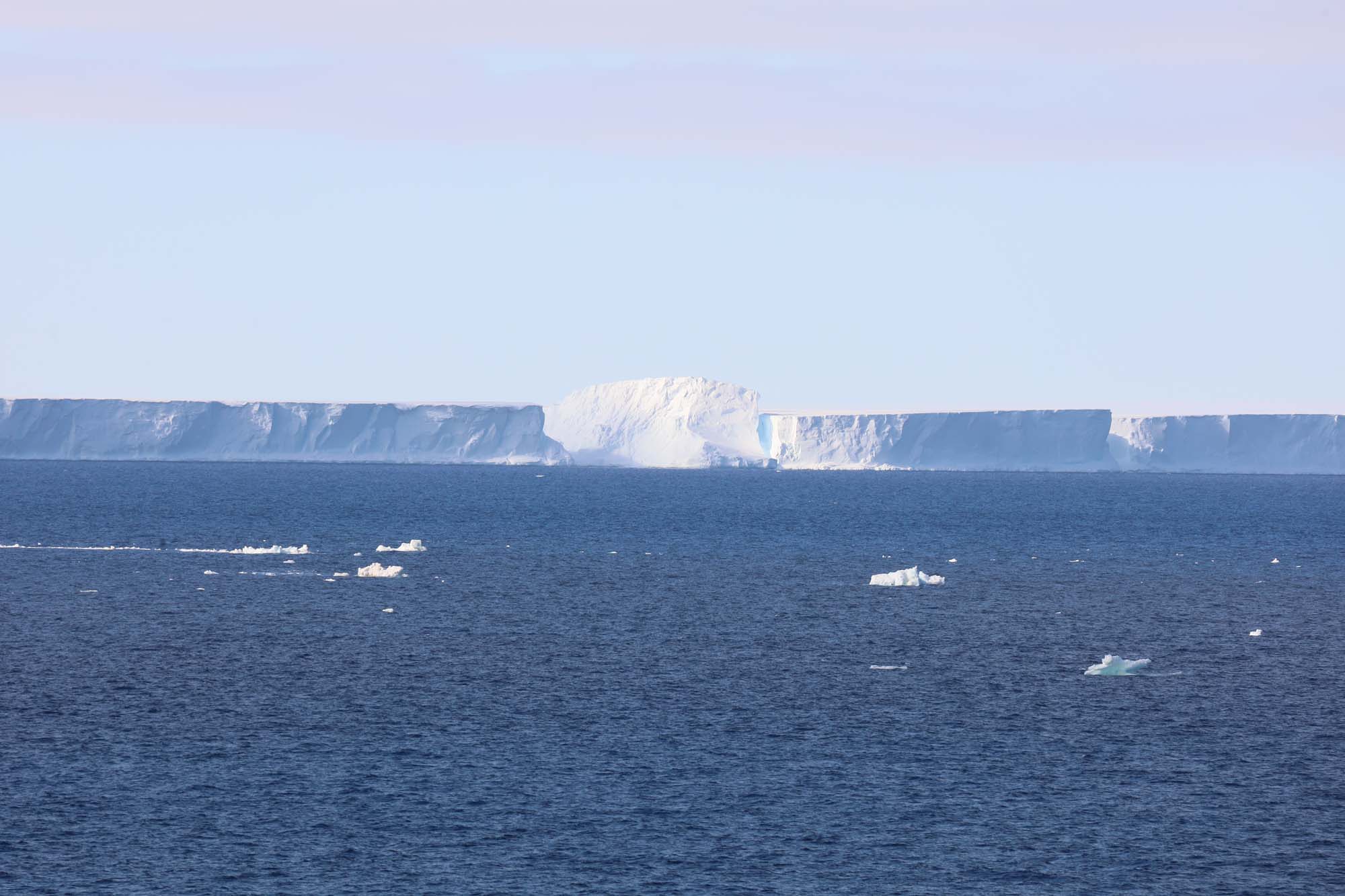
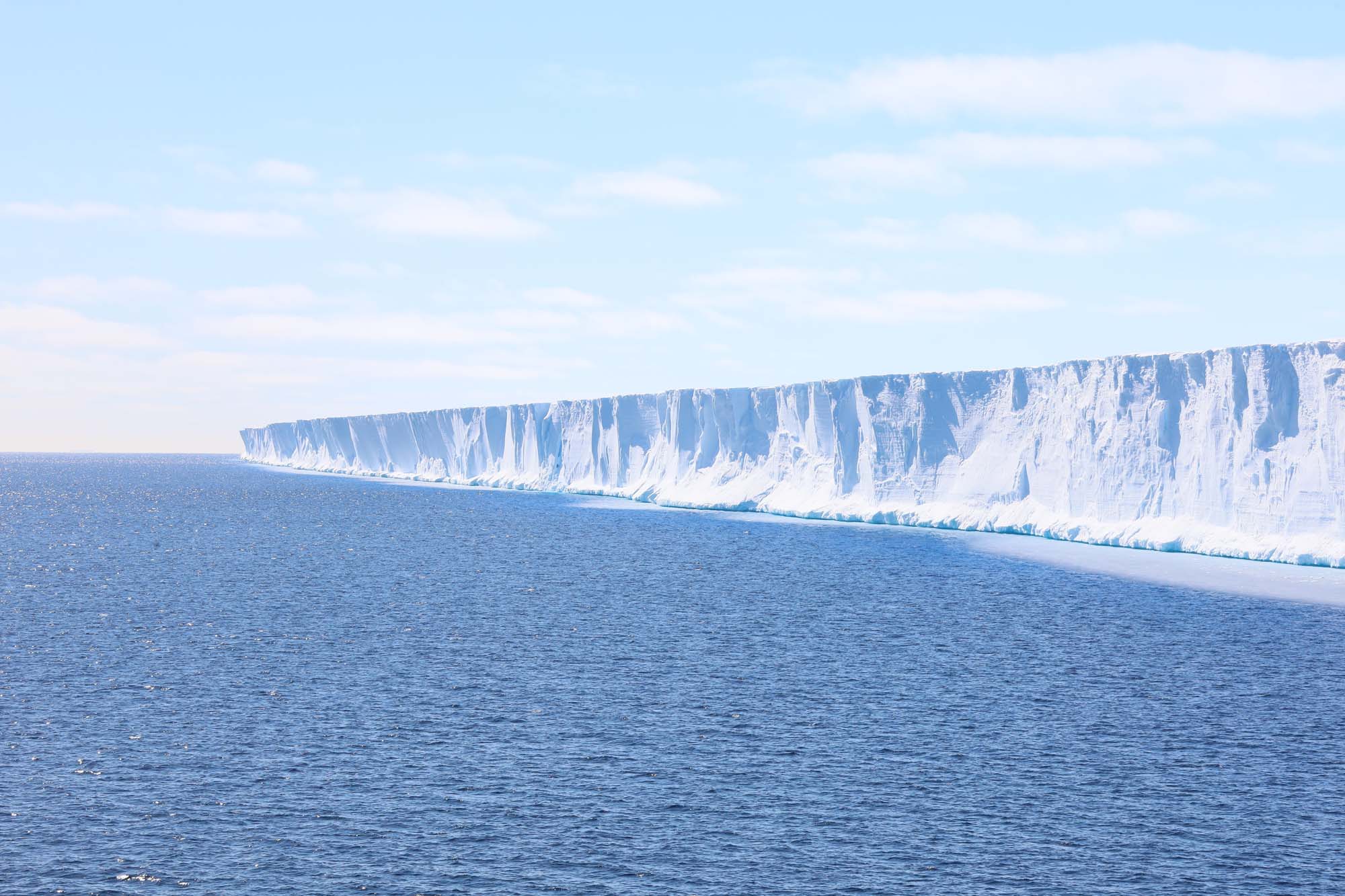
Ice shelves make up around 75% of Antarctica’s coastline. While the shelves themselves don’t directly contribute to rising sea levels, they do act as a vital line of defence against them.
These frozen masses serve as a natural brake for the glaciers that make up the Antarctic Ice Sheet, slowing their entry and the flow into the sea. In the case of the Fimbul Ice Shelf, it keeps the 200 km-long Jutulstraumen Glacier from sloughing off of the Antarctic continent and into the Southern Ocean.
“We would not only see a rise in sea levels, but an increase in extreme weather events and accelerated climate change.”
With around 60% of the world’s fresh water contained in ice sheets, it’s projected that a complete melt of these slabs could equate to a nearly 60 m rise in sea levels, an outcome that would be potentially devastating for the planet – and the reason why PERG’s research is so important.
“Shelf ice acts as a safety band, buttressing the outflow of the Antarctic Ice Sheet and moderating it. If the ice shelves were to retreat, deteriorate or disintegrate, the outflow from the sheet would accelerate,” Skatulla explained.
“That would have direct consequences on the global sea level and the Southern Ocean currents, which has global climate implications. We would not only see a rise in sea levels, but an increase in extreme weather events and accelerated climate change.”
Enhancing SA’s scientific standing
Since the signing of the Antarctic Treaty in 1959, scientists have been conducting substantial research activity on the continent, mainly studying the geomorphology of the earth’s crust beneath the ice sheet. However, there has been little investigation of the ice sheets and shelves.
“South Africa and our neighbours in the Antarctic, Germany and Norway, have been actively monitoring the Antarctic environment. The main focus has been on surveilling the earth’s crust to understand the history of Antarctica’s glaciers.
“What hasn’t been done for several decades now, particularly by South Africa, is monitoring the ice cover itself and the ice shelves or the actual outflow,” Skatulla said.
In this way, the “Monitoring and Modelling the Deteriorating Stability and Retreat of the Fimbul Ice Shelf Under the Influence of Global Warming” project signals South Africa’s rejoining of the international scientific community after many years of dormancy.
“While South Africa has been a longstanding member of the Antarctic Treaty – in fact, one of the 12 initial signatories – it hasn’t had a very strong presence in terms of glaciology or the monitoring of land- and ice-based phenomena in Antarctica,” Skatulla noted.
“Via our project, which was accepted in 2023 by the South African National Antarctic Programme (SANAP), we are essentially filling a longstanding gap in research and helping South Africa to rejoin the international community in this respect.”
Modeling Earth’s future
The PERG returned from their expedition on 15 February, bringing with them masses of data that can be fed into predictive models to forecast what changes in global temperatures over the next 50 to 100 years could mean for the Antarctic Ice Sheet, the ice shelves and the climate.
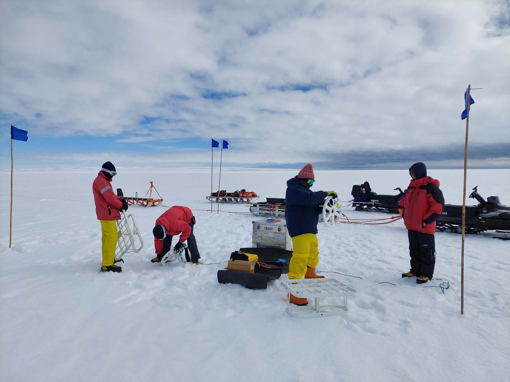
“The main aspect of our expedition was to gather data about the ice shelves. We used Phase-sensitive Radio Echo Sounding (pRES) to penetrate the ice shelf all the way to where it’s in contact with the ocean so that we could measure its thickness and monitor changes.
“Over time, this will help us to understand how the ice shelf might be changing due to melting on the underside and snow accumulation on the upper side. It also allows us to map crevices,” Skatulla explained.
Crevices are of particular interest to Skatulla and his team. These massive cracks ultimately lead to iceberg calving events, which create major uncertainty for those attempting to project potential sea level rise.
“When crevices are created and propagated, it ultimately leads to iceberg calving events. So, you want to monitor the internal crack propagation to see how stable the ice shelf is and when major calving events might happen,” he said.
To make these observations, the team used a combination of ground-penetrating radars, GPS, light aircraft and drones.
This combination was particularly useful for identifying and monitoring shear margins, areas where fast-flowing ice interacts with slower moving ice thereby increasing shelf instability and calving, which are relatively unpredictable and dangerous to explore manually.
Observations and outcomes
While it will take around a year for post processing of the data to be completed, Skatulla was able to share some observations about the current state of the ice shelves and climate change in Antarctica.
“There’s a very specific phenomena called the footloose rampart effect, which happens when there’s small-scale chipping that wears away at part of an ice shelf to form a protrusion or underwater hump that sticks forward under the water’s surface.
“This is something that’s been reported in literature, but it’s not that common to see. So, it was exciting to witness it myself, but in terms of how it changes the buoyancy of the ice shelf edge and how this can contribute to calving, it is not necessarily a good sign,” he said.
“We also had a very warm summer, which meant there were more melt days than usual. This was particularly visible when we approached the ice edge on our voyage, and when we were able to run around in shorts on some days,” he added.
“It was also clear during our voyage. My colleagues who have been part of annual SANAP voyages have reported that there’s usually a couple of 100 km of sea ice cover that you have to break through before you reach Antarctica. But this year the ice cover was relatively small, and we were able to get through it quite quickly,” he said.
Funded by the National Research Foundation’s (NRF) SANAP, Skatulla’s initiative has been made possible through collaborative support from the German Alfred Wegener Institute Helmholtz Centre for Polar and Marine Research and the Helmholtz Centre Potsdam – GFZ German Research Centre for Geosciences, and the German Space Agency (DLR).
 This work is licensed under a Creative Commons Attribution-NoDerivatives 4.0 International License.
Please view the republishing articles page for more information.